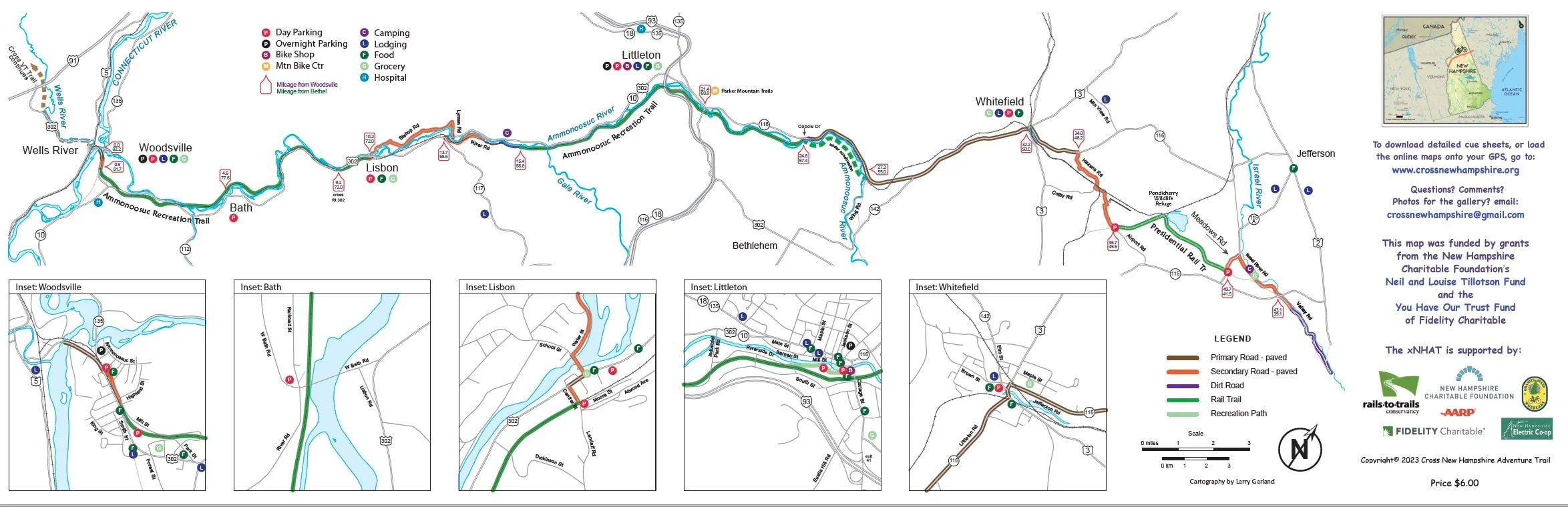
Paper Maps & PDFs
The 2nd Edition Paper Map is Available, and it's free!
This map is GREAT to have when planning your trip! The 7-panel, accordion-fold map is printed on a waterproof paper, perfect to guide you when planning your trip and while biking the trail. The 2nd Edition map includes the new miles of rail trail and more of the amenities along the way as compared to the first edition.
This map was designed by Larry Garland, the cartographer for the Appalachian Mountain Club. For a printed copy, just email your mailing address to us at info@xnhat.org and we’ll send you one by mail! Use this map along with the cue sheet or downloaded GPS data to provide all the information you need for your adventure.
Want to print it yourself or keep a digital copy?
Below are pdfs of the front and back side of the 7-panel map of the entire route. The map is too big to fit on a standard 8.5”×11” page, but you can print it out in sections, and tape them together. Best to have us send you a map!
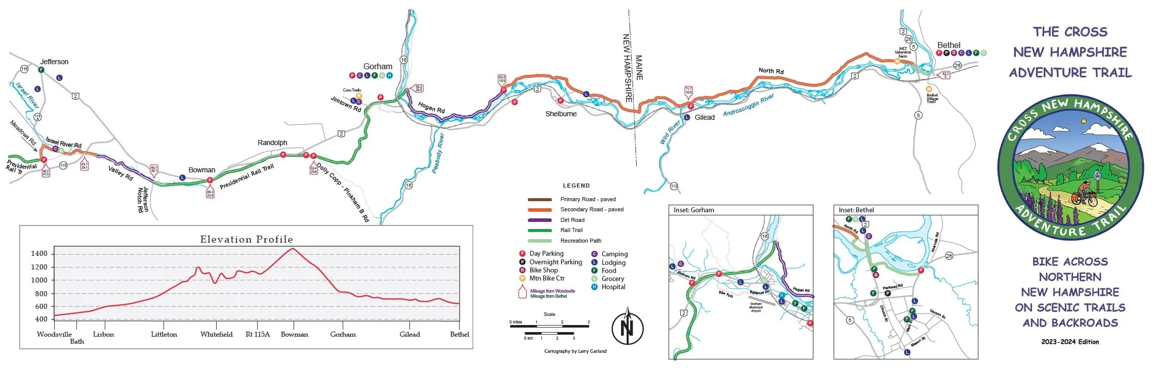
Online Maps
In 2022, we used $8000.00 of our grant money and donations for mailing the free maps, including envelopes and postage. YIKES! This was an achievement — But a big cost, too.
We love to plan trips via paper maps, so we are glad to send you the paper map for free and will continue to have them available for all. But since many of you like GPS online maps instead of paper, we cut our map and postage costs in 2023 by establishing a "Tourism" membership with RideWithGPS. We pay $499 per year for this, which allows you to download our RideWithGPS maps from thiswebsite and you will get all the benefits of a premium membership for free! You need to download the RideWithGPS app onto your smartphone or Garmin unit (free), then load the xNHAT map.
We Value Your Support!
If you love the map, love the RideWithGPS map and love the route... a voluntary tiny donation is appreciated and is used wisely and efficiently. Donations of $5.00 and more have been coming in to support us, the maps and postage and the RideWithGPS membership! These donations are REALLY appreciated and really help to fund the maps and mailings so that everyone can have the amenities. We then use all of our grant funding to improve the trails!