NOTE: The route is NOT suitable or fun for a skinny tire road bike!
Got a Gravel Bike? We Got Gravel!
Got a Gravel Bike? We Got Gravel!
Trail conditions as of Friday July 26th, 2024:
The xNHAT did not take a big hit from the July 10th flooding due to the remnants of Hurricane Beryl. Phew. The entire route is passable, just always use caution anywhere you may travel. Any gnarly parts either still due to issues from the December 18th storm and flooding, or they are just the gnarly "adventures" that make this route fun and a challenge.
Keep in mind that if you don't like the surface, it will change; if you so like the surface, it will change too. Just keep going, take your time, enjoy the scenery!
The Ammonoosuc Rail Trail is OK. There is occasional ballast rock scattered on the trail between Woodsville and Bath, but the part with sections of more ballast rock is between the Bath Covered Bridge and Lisbon (this section will be getting ledgepack surface within the next few weeks).
Caution at the GATES: Somehow the ballast rock gets piled up at the gates, likely by the ATVS trying to squeeze though, so just be careful at these gates. Put a foot down if you like and scoot through. Wide tires makes this easier!
In the Lisbon area the rail trail has been improving over the last year or 2 with sections of a hardpack surface covering the loose ballast and soft areas. The section north of the historic Lisbon Train Station used to be in bad shape so it was one reason why I routed the xNHAT off onto the quiet paved back roads for a few miles (School, Water, Bishop and Lyman Roads). With the new surface in this section of rail trail, it would be fine to stay on the rail trail north all the way to River Road if you like. There are a few rougher sections where the ledgepack and $$$ ran out, but they are short and most of the way is very nice!
We share the rail trail with ATVs and dirt bikes between Woodsville and almost into Littleton. We share this trail very well, they are polite and we are polite, too. Stay to the right side, go single file, they will too, they slow down for us and everyone is happy. We are collaborating with the ATV Club on this surfacing project. The ATV Club obtained the grants to pay for the new surface material, we have paid the match funding so that all of the trail users will have an improved surface to enjoy.
On weekdays you might only see a few ATVs, weekends you will see more. There is a business that leads newbies on ATV tours, you will see them out there. There is a leader and he/she keeps all their ducklings in a row and also keeps an eye out for others using the trail. Wave and say hi, the tour groups are thrilled to be out there and they will marvel at you on your bikes.
The section from Industrial Park Road though Littleton to Oxbow Drive has a gravelly surface. Your wide tires will float over it. Stop in Littleton for a lunch or snack, sit in the river to cool off on a hot day. At Oxbow Drive you must exit the rail trail and head out onto Route 116 to get to Whitefield. Any time now, a construction crew will be removing tracks and ties between Oxbow Drive and Wing Road, creating 2.3 more miles of rail trail and 2.3 miles less riding on the shoulder of Route 116. If you are a road bike rider, you will not have a problem with Route 116... it has a shoulder, good pavement and good lines of sight. However, road riding is NOT the spirit of the xNHAT, it is not as nice as biking off-road, so we have been working hard with the NH Bureau of Trails on extending the rail trail eastward. We have achieved grants over the past couple of years and now have 4.4 more miles of rail trail (Industrial Park Road to Oxbow Drive). With this next 2.3 miles coming soon, we will have extended the rail trail 7 miles. We are still working hard to continue the process and get rail trail all the way to Whitefield.
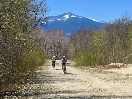
You will love the ride from Hazen Road to the Presidential Rail Trail through Pondicherry and all the way to Gorham. I route the xNHAT off the rail trail onto Meadow, Israel River and Valley Roads for the open field and panoramic mountain views. These views are obstructed by tree cover on the rail trail. In June the lupines bloom in the fields alongside the roads and it is delight to bike through them.
BEFORE Beryl, the Presidential Rail Trail had been hit hard with a lot of washouts and blowdowns from other storms. There was some quick repair work to keep the trail open for snowmobiles, but in a few places the surface needs more work to smooth it out for biking and walking (in Randolph between Pinkham B Road and Appalachia). The work will happen soon to address this, but until then, keep your eyes open for a few places of deep ruts, soft areas and rougher gravel. Essentially all of the way is a fine ride!
Don't flip out when you see the elevation profile! That big hump is a rail trail! Trains loaded with lumber used to do it, you can too! The gradual downhill from Bowman to Gorham is a really really nice ride!
Once in Gorham we share the rail trail with ATVs. It is only for just about a mile to use the trestle bridge over Route 16 and the Androscoggin River. After crossing the bridge ride about a half mile and you will cross over a small wooden decked bridge over the power canal. IMMEDIATELY after you cross this small bridge, there will be a gate and you will see signs for the xNHAT and a hiking trail directing you to take a right onto a single track. DO NOT miss this right turn. Follow the short single track to go up to access Hogan Road. Take a right on to Hogan Road and head east. As you travel Hogan Road eastward, keep the river on your right side! Opposite for westward travel.
(If traveling westward, look carefully for this single track connector. The sign is hard to see on a birch tree. It is located to the left side in a wide open area where there are tall power line poles and their support cables extending right into Hogan Road.)
Hogan Road is always an adventure, so just be prepared to walk your bike through some rubble and through some washouts. Not much new damage from Beryl, but the road is still littered with rocks and debris due to the Dec 18th flooding. During the flood, some parts of Hogan Road were covered with 10 feet of rushing river. There is one culvert washed out, but some fill was added so it is passable. Debris from the flooding makes it a challenge to ride in some sections, so please, walk your bike wherever you see rubble and washouts. It is part of the adventure!
Check here for updates on the trail conditions before venturing out there! If you are planning to head out there over the next couple of weeks, check here for updates or email me for a more detailed report: [email protected]
Info about the various sections of the route:
1. More details: Update on the Ammonoosuc Rail Trail:
In a unique collaboration with the NH Bureau of Trails, the Ammonoosuc Valley ATV Club and the xNHAT, a hardpack surface is being applied to the rail trail. The ATV Club has received significant grant awards for this project, the xNHAT has paid the required match funding. The first test of the hardpack material was at the end of August 2022 in Lisbon behind the furniture factory. It has withstood the weather and ATV use for almost 2 years and more material was applied in the fall of 2023 in areas near houses and businesses (amazingly.. there is NO DUST in this magic hardpack mix!) plus in areas of constant issues with washouts.
In the summer of 2024 the ATV Club will apply more hardpack surface material on more miles of the trail between the Bath Covered Bridge and Lisbon. and hope to cover most of the trail from Lisbon to Woodsville! This is an amazing accomplishment!
In August there may be trucks applying the new surface material and grading the new surface. The trail will not be closed, you just need to approach the work crew and obey their instructions for safe passage. They know you are out there and will let you go by when safe to do so.
The rail trail will be a gem not only due to the scenery, but due to the nice surface (in process) that is enjoyable for ALL of the allowed users! See photos below!
2. Hogan Road
The summer 2023 work projects did a good job of addressing issues at the eastern end of the road: a hefty new bridge was installed and the "Ponds" on the road filled and graded. However, the western end was not as lucky to get the attention. In addition, there was a huge flood on December 18th, 2023 that covered sections of Hogan Road with 10 feet of rushing water. If you are in there picking your way though the rubble, look for boat and trailer parts up in the trees.
Eversource, the power company, may get in there to fix the road, may not. They need to have the road suitable for heavy equipment to get in for maintenance on the dams and power lines, so there might be some repair projects, but no timeline is known.
3. Presidential Rail Trail:
A section located about a mile east of Pinkham B Road was TOTALLY washed out in 2 places during the December 18th storm. Repairs cost more than $50,000 just to fill these sections and restore the culverts. The surface in the area of the washouts has been fixed, but the trail in this area has some soft spots in the center likely due to the big equipment and trucks loaded with fill that had to travel the trail to the the washout sites. Just choose a good line on the sides, it's ok.
Also, from Pinkham B Road west past Appalachia the trail has storm related issues, too. There are some deep ruts and soft areas. This will be repaired over the next couple of months. The work crew will allow you to pass by...wave and thank them for the hard work!
The xNHAT did not take a big hit from the July 10th flooding due to the remnants of Hurricane Beryl. Phew. The entire route is passable, just always use caution anywhere you may travel. Any gnarly parts either still due to issues from the December 18th storm and flooding, or they are just the gnarly "adventures" that make this route fun and a challenge.
Keep in mind that if you don't like the surface, it will change; if you so like the surface, it will change too. Just keep going, take your time, enjoy the scenery!
The Ammonoosuc Rail Trail is OK. There is occasional ballast rock scattered on the trail between Woodsville and Bath, but the part with sections of more ballast rock is between the Bath Covered Bridge and Lisbon (this section will be getting ledgepack surface within the next few weeks).
Caution at the GATES: Somehow the ballast rock gets piled up at the gates, likely by the ATVS trying to squeeze though, so just be careful at these gates. Put a foot down if you like and scoot through. Wide tires makes this easier!
In the Lisbon area the rail trail has been improving over the last year or 2 with sections of a hardpack surface covering the loose ballast and soft areas. The section north of the historic Lisbon Train Station used to be in bad shape so it was one reason why I routed the xNHAT off onto the quiet paved back roads for a few miles (School, Water, Bishop and Lyman Roads). With the new surface in this section of rail trail, it would be fine to stay on the rail trail north all the way to River Road if you like. There are a few rougher sections where the ledgepack and $$$ ran out, but they are short and most of the way is very nice!
We share the rail trail with ATVs and dirt bikes between Woodsville and almost into Littleton. We share this trail very well, they are polite and we are polite, too. Stay to the right side, go single file, they will too, they slow down for us and everyone is happy. We are collaborating with the ATV Club on this surfacing project. The ATV Club obtained the grants to pay for the new surface material, we have paid the match funding so that all of the trail users will have an improved surface to enjoy.
On weekdays you might only see a few ATVs, weekends you will see more. There is a business that leads newbies on ATV tours, you will see them out there. There is a leader and he/she keeps all their ducklings in a row and also keeps an eye out for others using the trail. Wave and say hi, the tour groups are thrilled to be out there and they will marvel at you on your bikes.
The section from Industrial Park Road though Littleton to Oxbow Drive has a gravelly surface. Your wide tires will float over it. Stop in Littleton for a lunch or snack, sit in the river to cool off on a hot day. At Oxbow Drive you must exit the rail trail and head out onto Route 116 to get to Whitefield. Any time now, a construction crew will be removing tracks and ties between Oxbow Drive and Wing Road, creating 2.3 more miles of rail trail and 2.3 miles less riding on the shoulder of Route 116. If you are a road bike rider, you will not have a problem with Route 116... it has a shoulder, good pavement and good lines of sight. However, road riding is NOT the spirit of the xNHAT, it is not as nice as biking off-road, so we have been working hard with the NH Bureau of Trails on extending the rail trail eastward. We have achieved grants over the past couple of years and now have 4.4 more miles of rail trail (Industrial Park Road to Oxbow Drive). With this next 2.3 miles coming soon, we will have extended the rail trail 7 miles. We are still working hard to continue the process and get rail trail all the way to Whitefield.
You will love the ride from Hazen Road to the Presidential Rail Trail through Pondicherry and all the way to Gorham. I route the xNHAT off the rail trail onto Meadow, Israel River and Valley Roads for the open field and panoramic mountain views. These views are obstructed by tree cover on the rail trail. In June the lupines bloom in the fields alongside the roads and it is delight to bike through them.
BEFORE Beryl, the Presidential Rail Trail had been hit hard with a lot of washouts and blowdowns from other storms. There was some quick repair work to keep the trail open for snowmobiles, but in a few places the surface needs more work to smooth it out for biking and walking (in Randolph between Pinkham B Road and Appalachia). The work will happen soon to address this, but until then, keep your eyes open for a few places of deep ruts, soft areas and rougher gravel. Essentially all of the way is a fine ride!
Don't flip out when you see the elevation profile! That big hump is a rail trail! Trains loaded with lumber used to do it, you can too! The gradual downhill from Bowman to Gorham is a really really nice ride!
Once in Gorham we share the rail trail with ATVs. It is only for just about a mile to use the trestle bridge over Route 16 and the Androscoggin River. After crossing the bridge ride about a half mile and you will cross over a small wooden decked bridge over the power canal. IMMEDIATELY after you cross this small bridge, there will be a gate and you will see signs for the xNHAT and a hiking trail directing you to take a right onto a single track. DO NOT miss this right turn. Follow the short single track to go up to access Hogan Road. Take a right on to Hogan Road and head east. As you travel Hogan Road eastward, keep the river on your right side! Opposite for westward travel.
(If traveling westward, look carefully for this single track connector. The sign is hard to see on a birch tree. It is located to the left side in a wide open area where there are tall power line poles and their support cables extending right into Hogan Road.)
Hogan Road is always an adventure, so just be prepared to walk your bike through some rubble and through some washouts. Not much new damage from Beryl, but the road is still littered with rocks and debris due to the Dec 18th flooding. During the flood, some parts of Hogan Road were covered with 10 feet of rushing river. There is one culvert washed out, but some fill was added so it is passable. Debris from the flooding makes it a challenge to ride in some sections, so please, walk your bike wherever you see rubble and washouts. It is part of the adventure!
Check here for updates on the trail conditions before venturing out there! If you are planning to head out there over the next couple of weeks, check here for updates or email me for a more detailed report: [email protected]
Info about the various sections of the route:
1. More details: Update on the Ammonoosuc Rail Trail:
In a unique collaboration with the NH Bureau of Trails, the Ammonoosuc Valley ATV Club and the xNHAT, a hardpack surface is being applied to the rail trail. The ATV Club has received significant grant awards for this project, the xNHAT has paid the required match funding. The first test of the hardpack material was at the end of August 2022 in Lisbon behind the furniture factory. It has withstood the weather and ATV use for almost 2 years and more material was applied in the fall of 2023 in areas near houses and businesses (amazingly.. there is NO DUST in this magic hardpack mix!) plus in areas of constant issues with washouts.
In the summer of 2024 the ATV Club will apply more hardpack surface material on more miles of the trail between the Bath Covered Bridge and Lisbon. and hope to cover most of the trail from Lisbon to Woodsville! This is an amazing accomplishment!
In August there may be trucks applying the new surface material and grading the new surface. The trail will not be closed, you just need to approach the work crew and obey their instructions for safe passage. They know you are out there and will let you go by when safe to do so.
The rail trail will be a gem not only due to the scenery, but due to the nice surface (in process) that is enjoyable for ALL of the allowed users! See photos below!
2. Hogan Road
The summer 2023 work projects did a good job of addressing issues at the eastern end of the road: a hefty new bridge was installed and the "Ponds" on the road filled and graded. However, the western end was not as lucky to get the attention. In addition, there was a huge flood on December 18th, 2023 that covered sections of Hogan Road with 10 feet of rushing water. If you are in there picking your way though the rubble, look for boat and trailer parts up in the trees.
Eversource, the power company, may get in there to fix the road, may not. They need to have the road suitable for heavy equipment to get in for maintenance on the dams and power lines, so there might be some repair projects, but no timeline is known.
3. Presidential Rail Trail:
A section located about a mile east of Pinkham B Road was TOTALLY washed out in 2 places during the December 18th storm. Repairs cost more than $50,000 just to fill these sections and restore the culverts. The surface in the area of the washouts has been fixed, but the trail in this area has some soft spots in the center likely due to the big equipment and trucks loaded with fill that had to travel the trail to the the washout sites. Just choose a good line on the sides, it's ok.
Also, from Pinkham B Road west past Appalachia the trail has storm related issues, too. There are some deep ruts and soft areas. This will be repaired over the next couple of months. The work crew will allow you to pass by...wave and thank them for the hard work!
3. Photos from the trail work on Hogan Road and the Ammonoosuc and Presidential Rail Trails in 2023:
4. Rail Trail Projects in 2024:
Eastward Extension of the Ammonoosuc Rail Trail: Another 2.6 miles closer to Whitefield! Track and ties will start coming up soon...we have been told July...but looks like August. Can't wait for more rail trail!
Application of more hardpack surface material on the Ammonoosuc Rail Trail: Look for a new smooth, dust-free hardpack surface on the way from the Bath Covered Bridge north to Lisbon! This project should start in the summer. It will "fill in the gaps" between the short sections of hardpack applied in 2022 and 2023!
Application of a hardpack surface material on the Ammonoosuc Rail Trail in Littleton: The xNHAT and the NH Bureau of Trails will improve the surface of the rail trail for a mile or 2 in the Littleton area. Goal is Industrial Park Road all the way to the Rail Trail Village Apartments, maybe more! This will not start until late summer.
Restoration of the Presidential Rail Trail between Pinkham B Road and Jefferson Notch Road: The 6.4 mile restoration will restore the ditches alongside the rail corridor and repair or replace culverts, A hardpack surface will be applied where necessary to smooth out the surface. The repairs are all about water management: keep the water flowing AWAY from the trail, preventing erosion. The weather has been harsh, sections of the rail bed were completely washed away during the storm and flooding on December 2023. The repair projects will help to make the trail more resilient to the weather challenges.
If you are out there, please let me know of any new issues that you find (email to [email protected]).
Here are some details about the route!
Remember that this is an "Adventure" NOT a smooth easy boring blah route!
Reminder: The xNHAT is not suitable or fun riding a skinny tire road bike!
The Ammonoosuc Rail Trail has good areas and some wet and muddy areas, too. You will find a few sections of the rail trail between Bath and Lisbon where the rail bed and the surface has been repaired and restored using a nice hardpack material. Please do not bail on the rail trail and opt to ride on the edge of Route 302, it is dangerous. What shoulder is there is all cracked and it is the major highway for cars and trucks with a 50 mph speed limit (you know they are moving faster than that). NOT fun, You will prefer and enjoy taking your time getting through the few gnarly spots on the rail trail and enjoy the views and quiet, too. There are fewer gnarly parts than in the past due to the surfacing project!
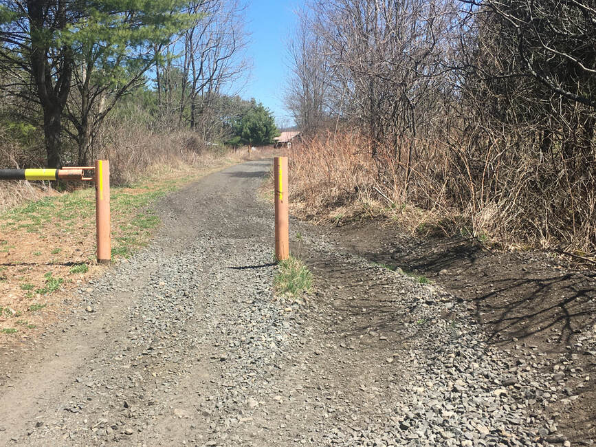
The newer section of the Ammonoosuc RT from Littleton to Oxbow Drive in Bethlehem has loose gravel scattered here and there, thick is some areas. You will need to bounce though some of it for short bits. Gates have been installed on this section of trail that will help keep the motorized users off and the trail surface in better condition.
The road ride from Oxbow to Whitefield is not bad. It has good pavement, a good shoulder for most of the way and good lines of sight. The big hill is not as bad as it looks! Stay single file and be good sharers of the roadway. It is a a fine ride for those used to road riding, BUT the spirit of the xNHAT is to be OFF-ROAD or on backroads, so we are working with the NH Bureau of Trails, snowmobile clubs, the Bureau of Rail and Transit to extend the rail trail further eastward towards Whitefield. In 2024 another 2.6 miles of this part of the xNHAT route will be on rail trail, rather than on the shoulder Route 116. We are getting there, mile by mile as we obtain grants and donations to help get this done! So far, 4.4 miles of the 11 needed have been accomplished, 2.6 more in 2024.
The Pondicherry Wildlife Refuge is a delight as usual. Do stop in there at the observation deck on Cherry Pond for a scenic break to enjoy the views, lunch and snacks. Look for beaver activities in the ponds alongside the rail trail.
The xNHAT is routed off of rail trail onto Meadow, Israel River and Valley Roads for the views! Plus, in June, the lupines in the fields are in full bloom. The rail trail has lots of trees with some obstructed views of the mountains, but these quiet backroads have wide open views. If you are doing an out-back starting from the western trailhead in Woodsville, or starring from Whitefield, go eastward on the xNHAT route, then take the rail trail when heading west on your way back.
On Israel River Road, stop at the campground for a bathroom break and visit the small camp store for treats and a water refill. They have ice cream treats in the freezer!
Valley Road changes from paved to dirt, and typically during the summer there will be a day or two when the road gets graded. The washboard and potholes disappear, BUT for those days and a day or so later, until it packs back down, the surface is likely bit tedious. The views will be worth it!
The Presidential Rail Trail from Jefferson Notch Road to Gorham is a great ride. However, there are a few spots that are rough. One area has mud even in a drought (likely due to a spring) so you can be sure it has mud now in the springtime. Due to a really big rainstorm and flood in December of 2023, there were many serious washouts on the rail trail. Most of them have been repaired enough for the snowmobiles to have a solid surface, but our surface may need attention in some areas. So keep your eyes open for other new washout areas or sandy areas as you enjoy the great downhill cruise to Gorham.
The rail trail from Gorham to the western end of Hogan Road is shared with a lot of ATVs and they have not been kind to the trail surface. Grin and bear it, it is not long and we need to share the big trestle bridge that spans Route 16 and the Androscoggin River. There is smaller bridge that spans the power canal about a half mile past the trestle bridge. IMMEDIATELY AFTER THIS SMALLER BRIDGE is the RIGHT turn onto a singletrack to access Hogan Road via a short signal track. There are signs and a pink ribbon! Look for this!! Mountain bikers will enjoy trying to bike the single track and all of Hogan Road. It is a fun challenge! Others will just hop off the bike and walk some of those rougher sections. That OK! Enjoy the road and be safe! It is a really nice trip though the woods next to the river.....however....see above about the flooding issues....
North Road (paved) from Shelburne to Bethel is a nice road ride. It is a quiet scenic road, with good pavement almost all the way. The traffic stays on Route 2, so North Road is a good bike ride even on busy summer weekends. There are some short hills, but what goes up slowly goes down quickly.
Saying this again: The route is NOT suitable for a skinny tire road bike!
At any season of the year you can find some places with mud, puddles, chunky gravel, washboard and soft spots on the rail trails and dirt roads, but remember it is an "adventure" so you will manage get through these areas! Enjoy! The weather is always changing, so check the forecasts carefully and be prepared for warm or cold weather, rain, wind... and also many beautiful days!
If it is dry, dust may be present on the rail trail sections shared with ATVs. (we have been working on this dust issue with the ATV Club and the NH Bureau of Trails, our new surface material is fantastic: smooth and no dust, good for all of the allowed users!)
In 2022, The Ammonoosuc Rail Trail was extended 4.4 miles eastward from Littleton! The new section goes from Industrial Park Road to Oxbow Drive. The surface is a packed mix of dirt, cinder and ballast. It was packed down by a vibratory roller, and it is now a better surface that what was left after the track and ties were removed, BUT it still has some areas of chunky ballast. It is NOT a smooth stone dust surface, it is more of an adventure than that. It is NOT good for a skinny tire road bike, but good for most everything else, it works. This eliminates biking on a busy section of Route 116 in Littleton, avoiding the intersection of Routes 116 and 302.
Here is the route in lots of detail:
Traveling eastward from Woodsville to Littleton and beyond:
When on the Ammonoosuc Rail Trail, you will get to Industrial Park Road, the first major road crossing at about 20 miles from Woodsville. You will see a big parking lot across the road and the "Frozen Adventures" ice cream stand in the parking lot to the right. Cross the road carefully and you will see the rail trail on the left side of the parking lot. Follow the rail trail and you will see the river and the town of Littleton on the left. If you are not going into town (but you should, its delightful!), just follow the rail trail about 4.4 miles to the current "End of the Line" at Oxbow Drive, a dirt road that is adjacent to where the rail trail ends. Take Oxbow Drive eastward for a very short bit uphill where it will intersect with Route 116. Take a right and follow 116 North to Whitefield. Ride safely on the shoulder, and be grateful that the new rail trail avoided a few of the hills and traffic on Route 116 (not ALL of the hills or traffic, however...).
To stop in Littleton for lodgings, food, brewery, cafe, market, candy, etc., exit the rail trail at Riverside Drive, by going left where the trail crosses the road. You will see a pumpkin colored house ahead on your right. There is a narrow dirt bike/ped pathway, right in front of the pumpkin colored house. You will feel like you are crossing their front yard! You are, and that is OK. Note the suspension bridge there, a fun way to get to the Main Street of Littleton! Return to the rail trail by the pedestrian covered bridge to Riverglen Lane, ride the rail trail out to Route 302 by The Little Grill and carefully cross Route 302. Stay on the rail trail to the end where the trail ends just before the tracks/ties begin. Exit there onto Oxbow Drive and go up this short dirt road to ride on 116 North to Whitefield.
When heading west from Whitefield towards Littleton:
Oxbow Drive is a dirt road on the south side of Route 116. It is about 7.5 miles from the center of Whitefield. As you are riding westward on the shoulder of Route 116, Look for it on your left, it is before a hill. USE CAUTION TO CROSS ROUTE 116!! Be patient and wait for a clear crossing, the cars and trucks are moving fast down the hills, so just wait for a safe time to cross. Enter Oxbow Drive and go a short distance down the dirt road, the rail trail is on your left. Enjoy it all the way in to Littleton. If you want ot access the town, you can exit the rail trail at Cottage Street (Route 302) across from the Little Grill Restaurant (the old Railroad Station). Go right and turn left almost immediately at the Freehouse Restaurant and Littleton Bike Shop. Ride to the bike/ped covered bridge and cross over to each the amenities on Main Street.
Please email us if you have any questions: [email protected]
----------------------------------------------------------------
*** The xNHAT is not suitable for a skinny tire road bike!
Have I said this enough???
The on-road sections are certainly fine for a road bike (North Road in particular) but YOU WILL NOT enjoy the entire route on skinny tires. The surfaces of the rail trails and dirt roads are best for wider tires (35mm or more is better), gravel bikes, hybrids and slick or slightly knobby tire mountain bikes. A mountain bike with heavy knobby tires will be ok on the dirt roads and trails, but sluggish overkill on the paved and smooth dirt road sections. Wider tires will allow you to look around and enjoy the scenery, as compared to constantly looking at the changeable surface conditions in front of you.
We suggest downloading the GPS tracks onto your smart phone or GPS, getting the FREE fold out map AND carrying the cue sheet for route details (print out the cue sheet from the maps/cue sheet page). Better to have too much information than too little.
There are a few places where it is not easy to see the turn, so best to have all the info available: getting off of Hogan Road onto the Presidential Rail Trail in Gorham, getting onto the Ammonoosuc Rail Trail off of River Road in Lisbon, getting onto Meadow, Israel River and Valley Roads in Jefferson (these roads parallel the rail trail for a few miles and provide stellar views that are not seen from the rail trail's green tunnel!)
You have likely noticed the word "Adventure" in the name of the Cross New Hampshire Adventure Trail. This is in there because you will certainly find adventures along the way. Along with the scenic beauty of the mountains, forest, fields, ponds, rivers and streams, the adventures include variable trail and road surfaces, sudden detours, weather, washouts. The rail trails are generally "natural" surfaces (mostly hard packed, consisting of cinder, dirt, some ballast, gravel... NOT the beautifully manicured hard packed stone dust or paved surfaces of the flatlands!). ATVs are a North Country favorite sport, you will see them on the Ammonoosuc Rail Trail (a good example of sharing the trails) and on a short section of the easternmost part of the Presidential Rail Trail (they can be numerous here, grin and bear this short section, the ATVS have wreaked the trail surface), especially on weekends.
So, enjoy the challenges along the way, they make for the best stories to share for years to come.
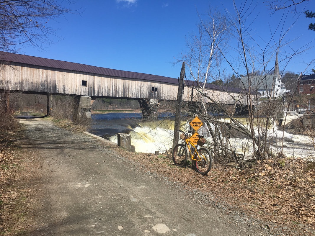
Ammonoosuc Rail Trail near Woodville: The bridge over Route 302 was replaced and decked with wood planks, but the larger ballast rocks are still in place as you approach the bridge from either side. Please use caution!
Ammonoosuc Rail Trail: From Woodsville to Lisbon:
Woodsville to Bath is Ok. Bath to Lisbon, well, it has some issues, but they come and go. We are working on this, I think this is currently the bumpiest part. It will get a ledgepack surface this summer!
On August 30, 2022, the section of the trail in Lisbon behind the furniture factory received a new surface! It goes only about 0.6 mile, an experiment to test the surface material for use by motorized and non-motorized trail users. They say it can't be done, but we think that "Chief", of Chief's Quarry in Vermont, has put together a magic mix for us. So far it is a BIG improvement to the trail! We will be watching this for its resistance to washouts, ruts, washboard and dust. After the water and now mud season, the surface is looking great! the surface has no dust issues! We are collaborating with the ATV Club and the NH Bureau of Trails to do more restoration and resurfacing in 2023!
In the other sections of the rail trail there are areas of gravely stuff, especially around the gates, so use caution there. You will appreciate wider tires here. Adventure, remember? What's that new gravel bike for, anyway?? The gravel is being flung off to the side by the ATVS, which is good news, BUT, at the end of the season, the ATVs create washboard, bad news... typically you will be able to avoid it if you stay on the sides of the trail. There are a few lumpy areas south of the tunnel near Lisbon. Spring means wet and mud and potholes and leftover washboard. The tail will be graded and improved once equipment can get in there.
The ATVs in this area are typically mellow and enjoying the scenery as much as you are. They will typically wave and slow down when they see you. Wave and move over to the side of the trail. Stay in your line when they appraoch, and don't be a squirrel darting back and forth across the trail. This rail trail is a good example of all trail users sharing the trail well. There can be rare exceptions to this rule on both sides.
On-road section from Lisbon (Bishop and Lyman Roads) to Rt 302: Paved roads, all good, some places have really nice pavement, the worst section was paved smoothly on 2021!
Rt 302 to River Road and back on the rail trail: Some of the pavement is good, some not as good. The river views are very pleasant in this area. Part of River Road is dirt. It is a much better ride on the dirt road than the (gravelly) rail trail in this area, so stay on River Road, don't be tempted to get onto the rail trail too early. There is a KOA campground ACROSS the river from where you are riding on River Road, you will see the camper vehicles along the riverside through the trees. AFTER you pass by this campground located on the other side of the river, start looking for the right turn onto a short uphill rocky dirt access road that goes about 30 yards to rejoin the Rail Trail. There is a small No Trespassing sign in the woods at the turn, this means to not continue straight on the dirt road, you will end up in a private yard at the Dead End. Instead, go up this short dirt access road to the rail trail and take a left, go thru the gate and continue on the rail trail heading towards Littleton. Be cautious, occasionally trucks haul gravel from quarries located off of River Road.
Ammonoosuc Rail Trail: From River Road to Littleton: It typically is hard packed and in better shape than the more westerly sections.
NEW SECTION OF RAIL TRAIL from Littleton to Oxbow Road: 4.4 miles! See description above! It has some issues, but MUCH better that being on a busy roadway.
Oxbow Road to Whitefield to Pondicherry Wildlife Refuge (Rt 116, Hazen and Airport Roads): Paved roads, not what the xNHAT is all about but we are working on this. Route 116 is a true road ride... it has a good shoulder, good pavement and good lines of sight. However, use your road riding skills and stay far right on the shoulder, single file. You will climb and you will see more cars and trucks here than on any other road of the xNHAT. This up/down road ride will be eventually be converted to a rail trail ride. It is looking good for another 2.6 miles of rail corridor to be converted to rail trail in the late fall of 2023. That's 2.6 less miles on Route 116. Yay!
Pondicherry Wildlife Refuge: The 4 mile section of the Presidential Rail Trail in the refuge is in good shape. The work done 3 years ago to restore, crown, ditch, add new culverts and 4 Beaver Deceivers has made this section good for early season use. However....the new ledge pack surface is more coarse than a typical stone dust rail trail. Some sections are more "more coarse" than others. Raking and continued use has improved the surface. There is a porta-potty (May to November) and a Dero Fixit Bike Repair Station and pump in the parking lot at Airport Road.
Meadows, Israel River and western end of Valley Road: Paved and in good shape. These roads have excellent views of the Presidential Range, and they travel though some of the best fields of lupine in mid to late June. Take these roads as a more scenic option than the rail trail in this area!
Valley Road (dirt section). This road is typically in good shape. Panoramic mountain views are always here to see if you are lucky to have clear skies. There will be some snow dusting the mountain tops this month, it is great to see the snow as spring arrives!
For the panoramic mountain views, be sure to exit the rail trail after Pondicherry onto Meadows Road (Route 115A), follow the cue sheet and map carefully here! Do not stay on the rail trail or you will miss the panoramas. Take Meadows, Israel River and Valley Roads eastward. If doing a looped day ride out of Pondicherry, I suggest doing the Meadows-Israel River-Valley Road route EASTWARD for the panorama, then return westward via the rail trail.
Presidential Rail Trail, Jefferson Notch Road to the Bowman parking lot: You will encounter a short section of mud, a few big rocks and soft areas within a 0.3 mile section to the west of the Israel River Bridge. All this is ridable or walkable with caution. It is better, but there are some ruts, from the bridge eastward. All rideable, just keep our eyes open for any issues to ride around. Stop your bike to look around and soak in the views! There is some rough gravel right at the edges of the Israel River Bridge.
Presidential Rail Trail, Bowman to Pinkham B Road: There are a few sandy spots, soft areas and a few short bits of gravelly surface. here is another section that will be restored late this year. The downhill rail grade is GREAT! You may see moose and bear, they are often viewed in Randolph and in the Pondicherry area. There is a porta-potty for all to use at the Pinkham B Road area from May to November. Look to the right side of the fire station/public works building, it is partially hidden by pine trees!
Pinkham B Road to Gorham: Wow, what a difference the restoration work done in June of 2021 has made on this trail! Enjoy this 9.5 mile downhill gem!
Gorham to Hogan Road: UGH!!! The ATVs have caused damage to this section of the trail. This short section (Rt 2 parking lot to the junction with Hogan Road) is shared with ATVs. There can be LOTS of them on the weekends. From this location they can access 1000 miles of trail, so they come from everywhere to enjoy this riding mecca. To control dust in the residential area, about a 0.1 mile section of the rail trail was paved. Enjoy this short section! HOWEVER......After the pavement ends you WILL have soft areas and loose rocks. It can be a bit better if the rain has packed it down. Take it slowly, walk the worst spots and take it as part of the adventure, it will not be bad for too long, you will be on Hogan Road soon. This issue needs to be addressed, somehow the trail must be restored and be enjoyable for ALL allowed users.
Hogan Road: In good shape (for Hogan Road)! Likely some mud and wet areas, but Hogan always has some issues. Part of The Adventure. It is a beautiful unmaintained dirt road. The rocky areas, sand, etc. from the big floods and washouts of 2017 are all still there...part of the fun. It has been fun to weave around the puddles, obstacle course style. Most consider this to the be best part of the entire route, a few others say just the opposite. Something for everyone on this route! Look for the Osprey nest on a new platform near the power poles. The osprey may be angry at you for being close to their nest, they may squawk and dive towards you..
Finding Hogan Road and the Presidential Rail Trail:
To find Hogan Road from the rail trail, heading east: The short little access trail is IMMEDIATELY on the right after crossing the short bridge over the power canal, BEFORE THE GATE. It really, truly is immediately after the bridge, look hard to your right. The access entrance has 2 small xNHAT signs: a small signs on a birch tree for the xNHAT and a hiking trail, anther sign next to the gate. Use your cue sheet and watch your odometer. If you miss this entrance, you can access Hogan Road from an open parking/work/staging area on the right about 0.1 mile from the small bridge over the power canal.
To find the Presidential Rail Trail from Hogan Road, going WEST... Once you pass the old brick power building/dam, you will go slightly uphill and back into the woods. When you emerge to an open area, there will be many big tall power poles on your right carrying power lines. Up ahead on the left will be a narrow single track that leads steeply downhill. There is a sign on a tree, but it is at the edge of the woods and likely covered with leafy branches. I cannot put signs on the power poles, which would have made this easier! When the power pole and guy wires are right near the dirt roadway, look to the left for that single track. If you miss this, a short distance ahead is a rough dirt road access to a staging area for the power company. It also goes steeply down to the left. The rail trail will be visible, take a left and deal with the ATVs, dust and some unpleasant, some bad surface conditions for about 1.2 miles. You will be pleased at that point to be on the non-motorized section of the Presidential Rail Trail, a highlight of the route!
North Road to Bethel: All paved, a fantastic pavement ride. Most of the pavement is new as of 2 years ago. Some sections are not new and require the usual care looking for cracks and broken pavement.
Please realize that conditions change a lot, especially after rain. I try to keep up with everything, and rely on cyclists and walkers, like you, to help keep this Trail Conditions page up to date! Email me if you see an issue that needs to be shared with other trail users and the NH Bureau of Trails: [email protected]
Enjoy your ride!! s
April 9, 2021. Israel River Bridge heading west towards Jefferson Notch Road. You will encounter some wet and muddy spots for about 0,3 mile.
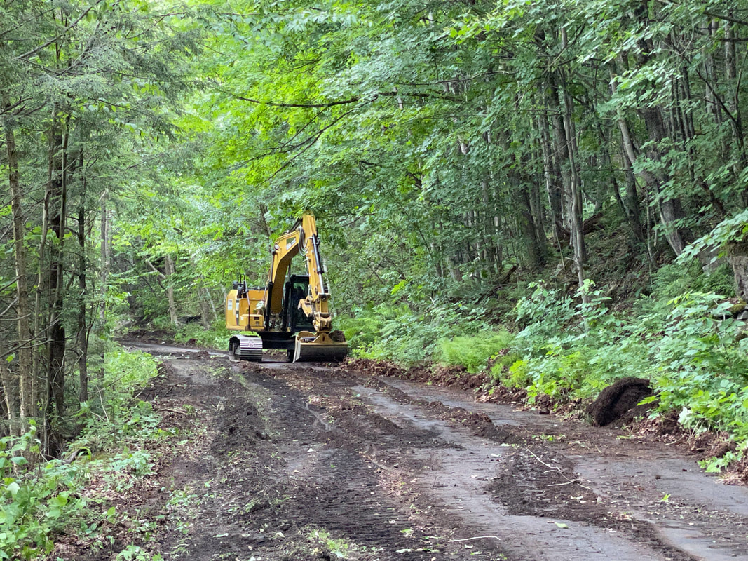
June 16, 2021. Chris the excavator operator sculpts the Presidential Rail Trail, Gorham to Pinkham B Road. The restoration includes restoring the drainage ditches and crowning the trail so that water will drain away quickly away to the sides of the trail, not right down the middle!
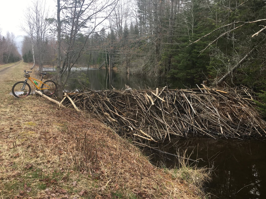
This is the tallest beaver dam I have ever seen. The water is lapping at the trails edge. May 5, 2020, Presidential Rail Trail, Jefferson.
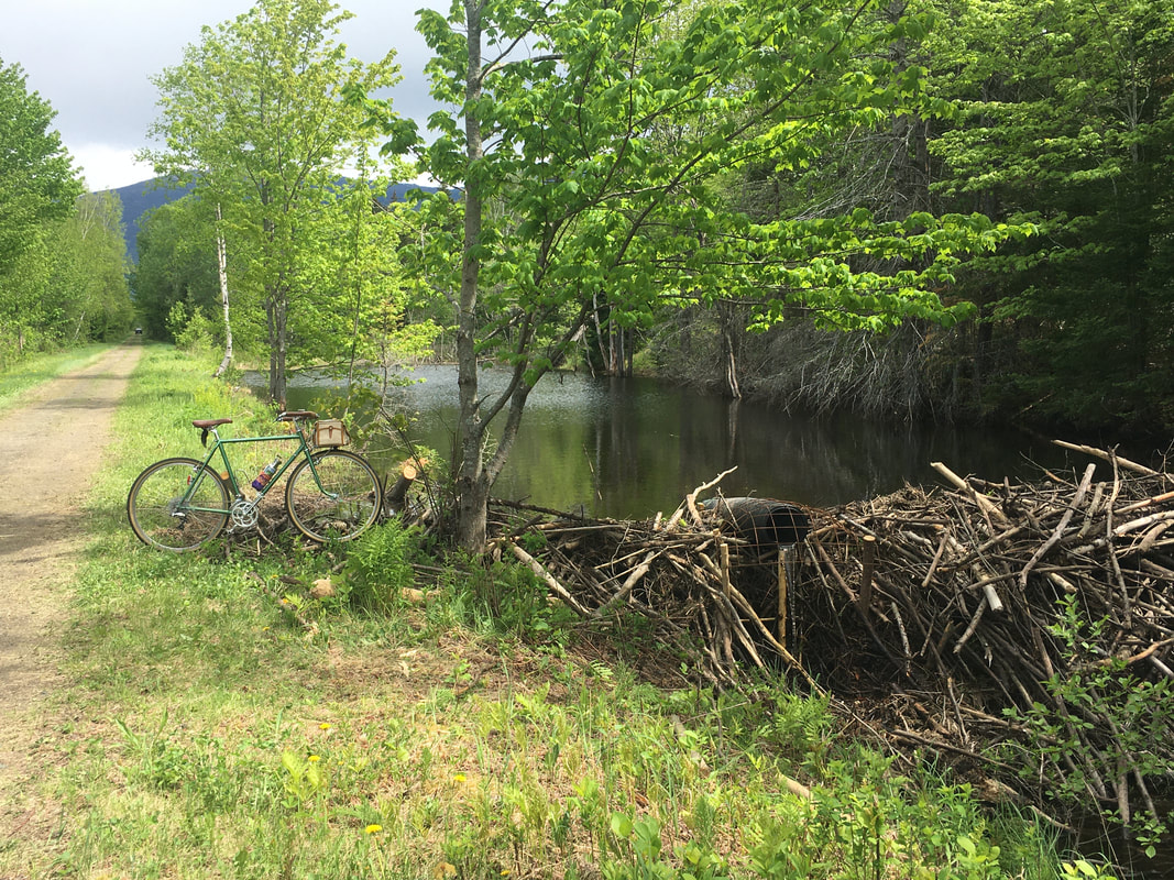
June 1st, What a difference a Beaver Deceiver can make! The height of the black outlet pipe is now controlling the water level. The new lowered pond level will not threaten the trail anymore but will still be good for the beavers and the surrounding wetlands. Win Win Win.
May 2, 2020 The Ammonoosuc Rail Trail has its issues with uneven surfaces and gravel at the gates. Caution!
May 2, 2020. The Ammonooosuc Rail Trail has its various issues or "Adventures", but it is a beautiful ride along the river, well worth the various surface conditions!
Here is Hogan Road, the eastern section, no problem with conditions here! This area is elevated from the riverside, so no damage from the flooding.
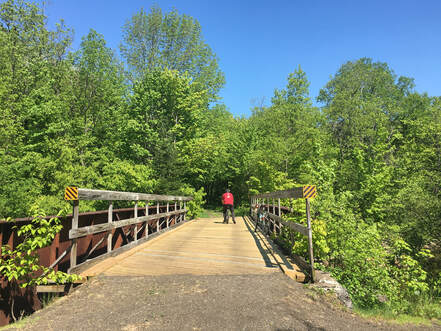
New railings on a bridge located near Gorham on the Presidential Rail Trail.
|
Contact Us:
Disclaimer: The Cross New Hampshire Adventure Trail and the authors of the website, social media and maps strive to prepare accurate information about the route and the conditions. However, they make no warranty, representation, or guaranty as to the accuracy of any information presented. Conditions on the route can change without warning due to weather, flooding, wear and tear, construction, tree falls, vehicles on the route, etc. You should verify the accuracy of all information obtained from this web site, wear a helmet and abide by safe bicycling standards. By using or relying on any material contained on this site, the user knowingly waives any and all claims for damages against any and all of the entities comprising the Cross New Hampshire Adventure Trail that may arise from the contained information.